Dunbrody estate maps, c. 1840s
The following townlands are documented in eight folio volumes covering the Dunbrody estate. A separate map is given for each townland followed by an abstract of the holdings (including each farm number, tenant’s name and acreage), in addition to a subsequent series of maps showing each individual holding, accompanied by a description and (Irish) acreage.
Some of the townland maps are missing (see list below). Where an abstract is missing, the archives staff has created one using the information from the individual field maps. These maps are based on the 1st edition of the Ordnance Survey (c. 1840s)
Ballygow
Lord Templemore Estate Ballygow Abstract

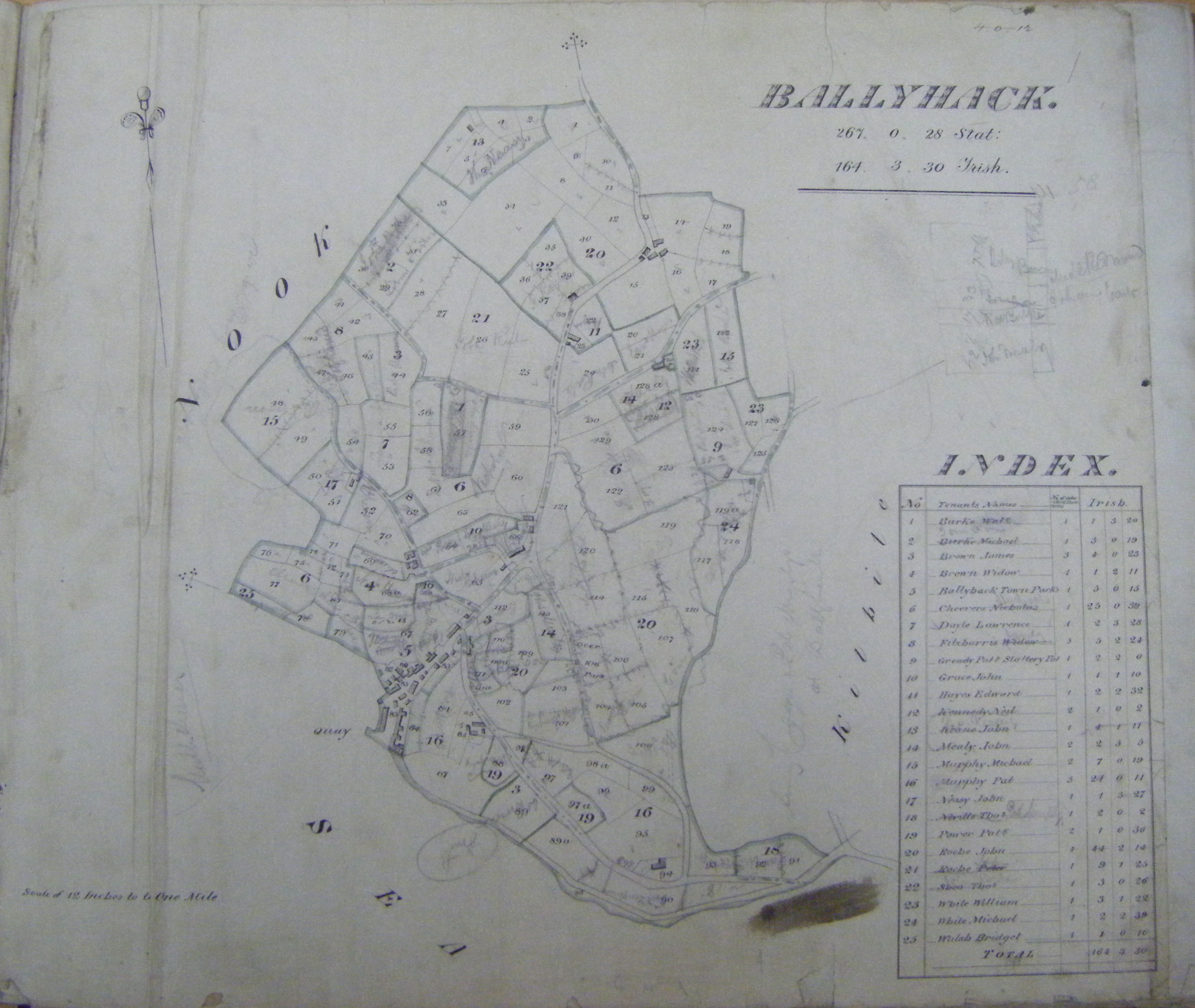
Ballyhack
Lord Templemore Estate Ballyhack Abstract
Battlestown
Lord Templermore Estate Battlestown Abstract
(Map missing)
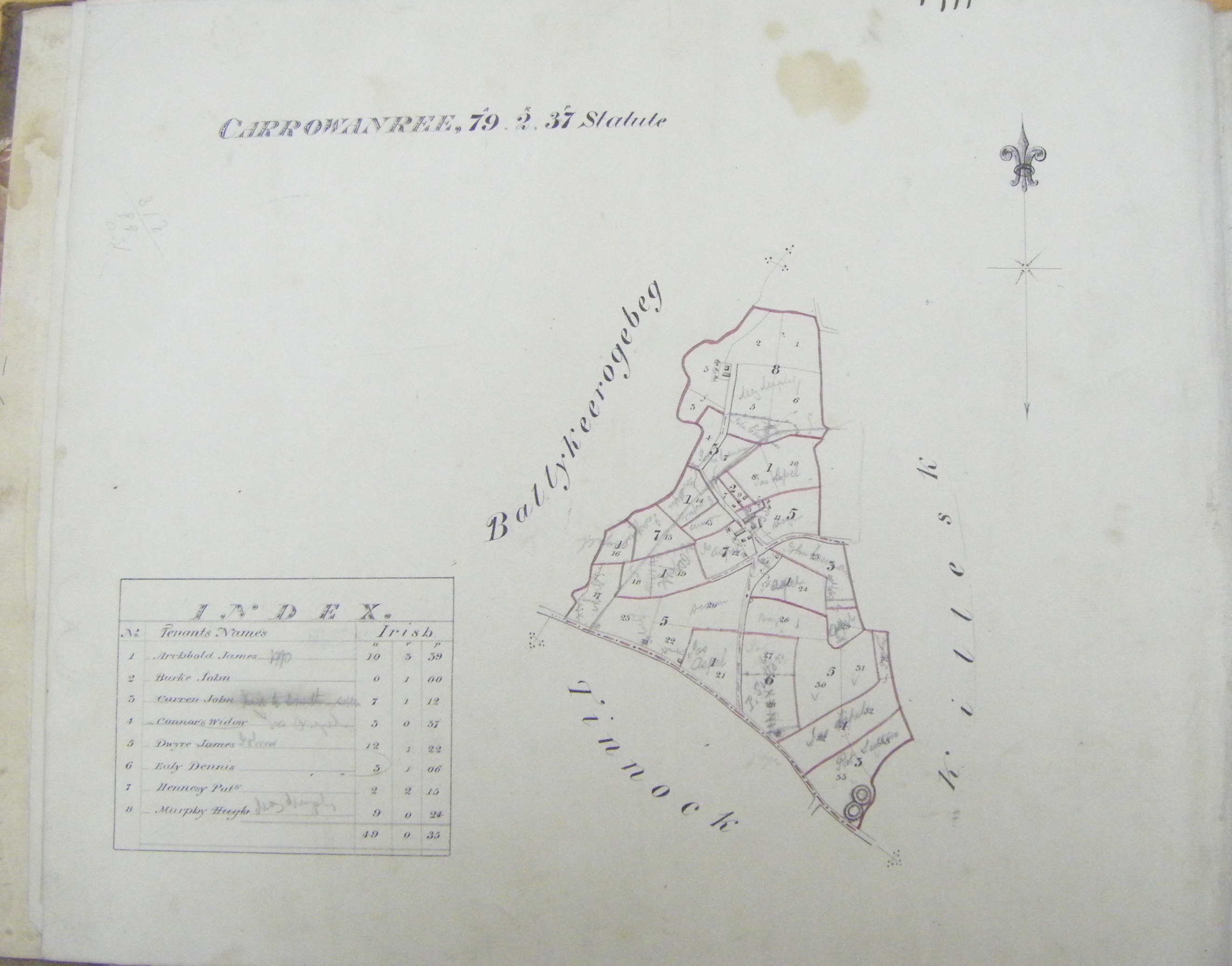
Carrownaree (Kingsquarter)
Lord Templemore Estate Carrowanree Abstract
Clonlard
Lord Templemore Estate Clonlard Abstract
(Map missing)
Clonsharragh
Lord Templemore Estate Clonsharragh Abstract
(Map missing)
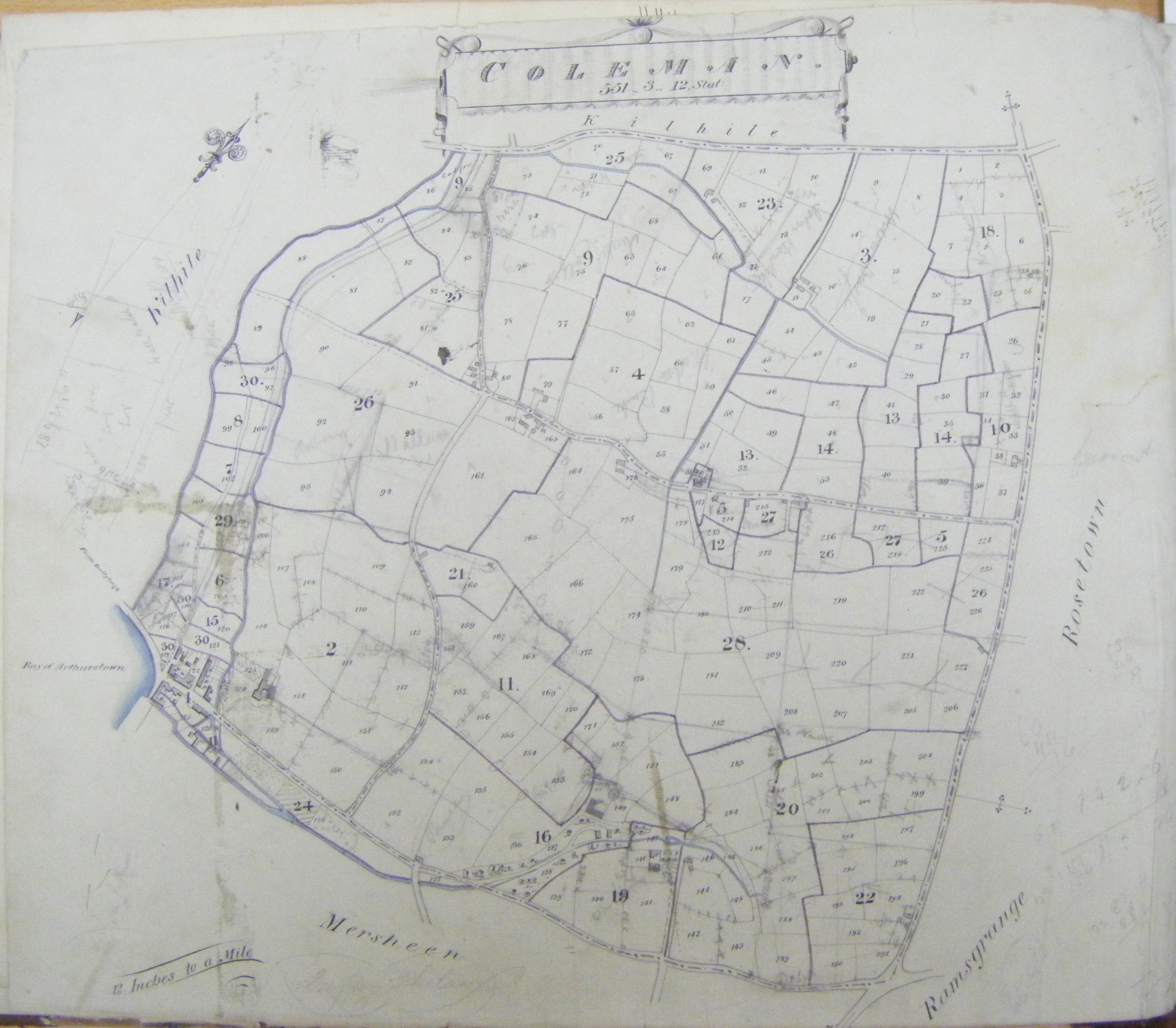
Coleman
Lord Templemore Estate Coleman Abstract
Curraghmore
Lord Templemore Estate Curraghmore Abstract
(Map missing)
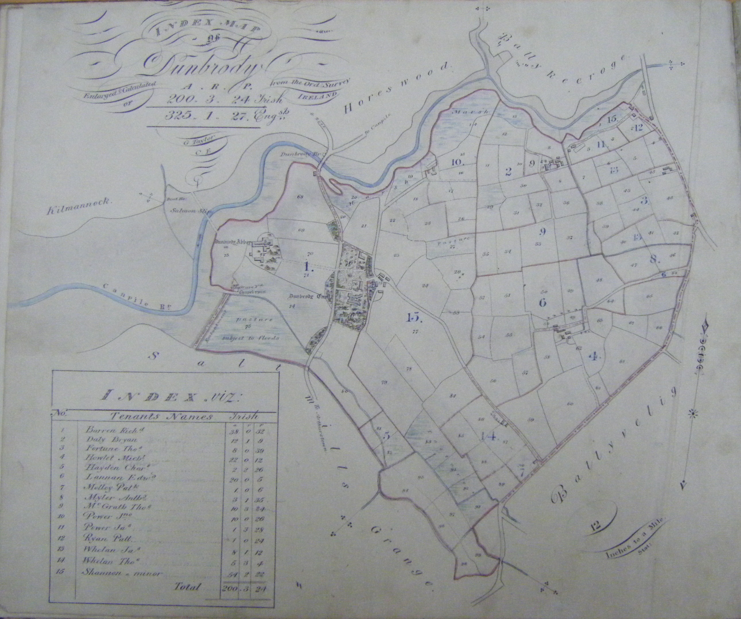
Dunbrody
Lord Templemore Estate Dunbrody Abstract
Duncannon
Lord Templemore Estate Duncannon Abstract
(Map missing)
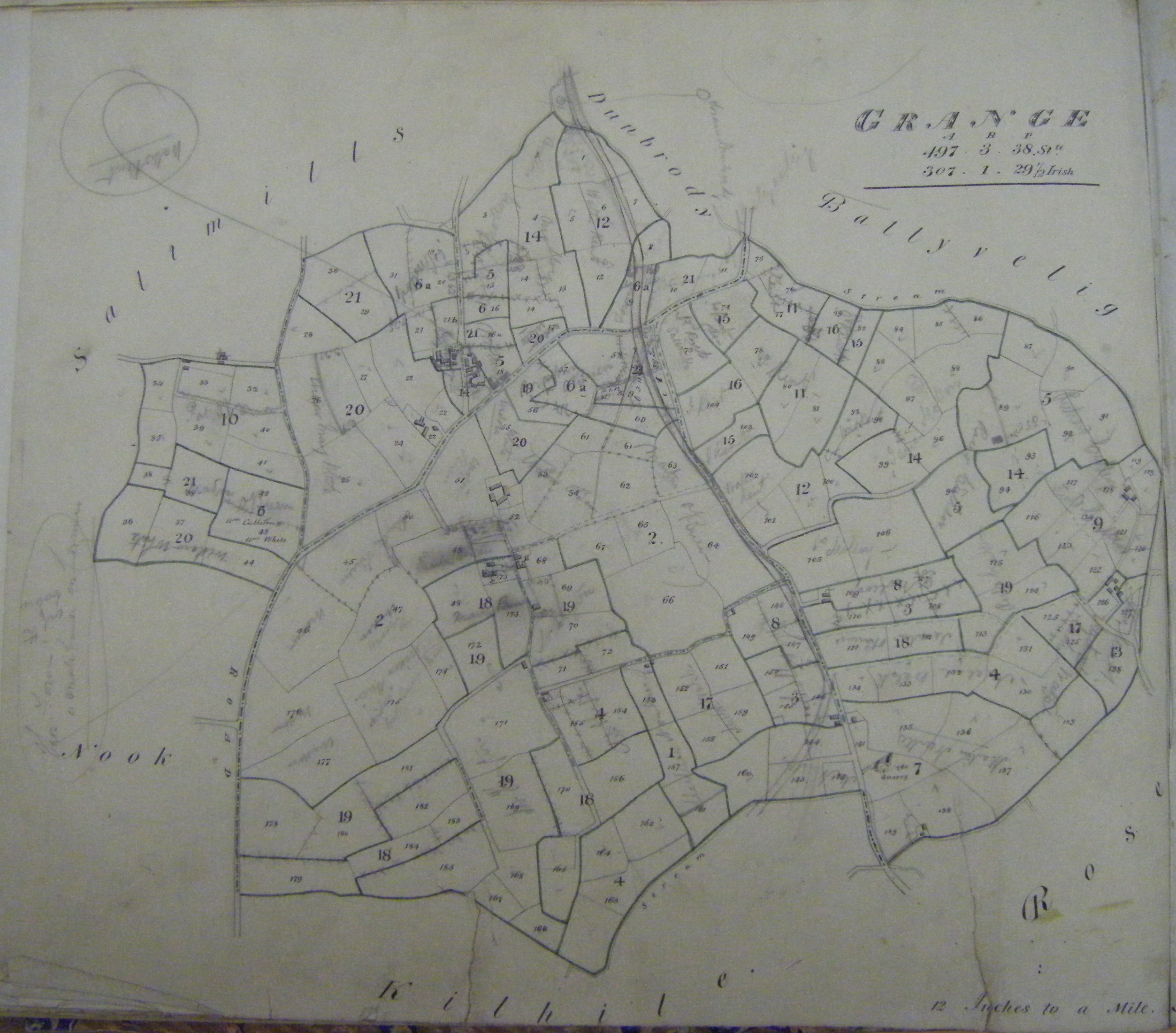
Grange
Lord Templemore Estate Grange Abstract
Haggard
Lord Templemore Estate Haggard Abstract

Kilbride
Lord Templemore Estate Kilbride Abstract

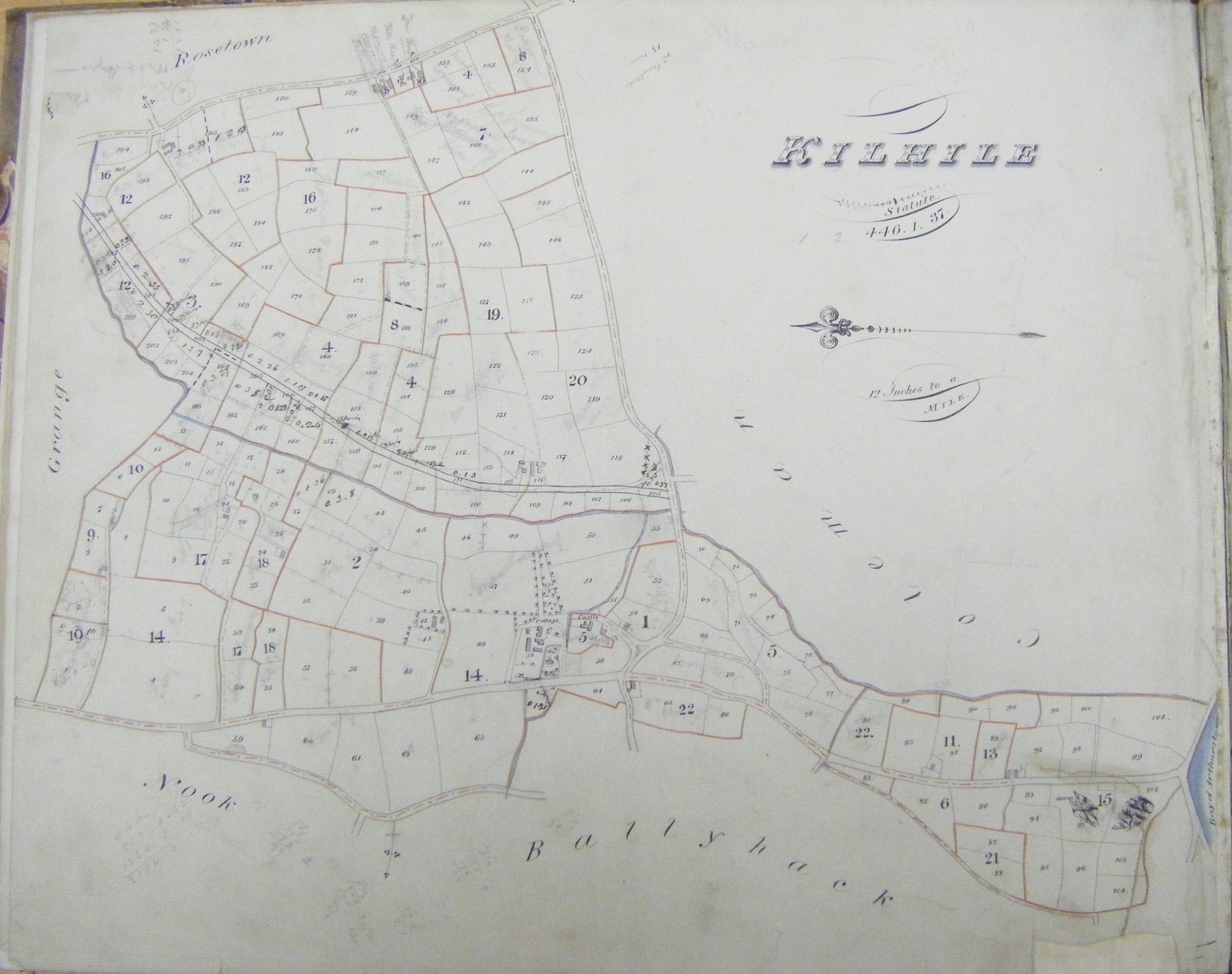
Kilhile
Lord Templemore Estate Kilhile Abstract
Mersheen
Lord Templemore Estate Mersheen Abstract
(Map missing)
Nook
Lord Templemore Estate Nook Abstract
(Map missing)
Rosetown
Lord Templemore Estate Rosetown Abstract

Saltmills
Lord Templemore Estate Saltmills Abstract
(Map missing)
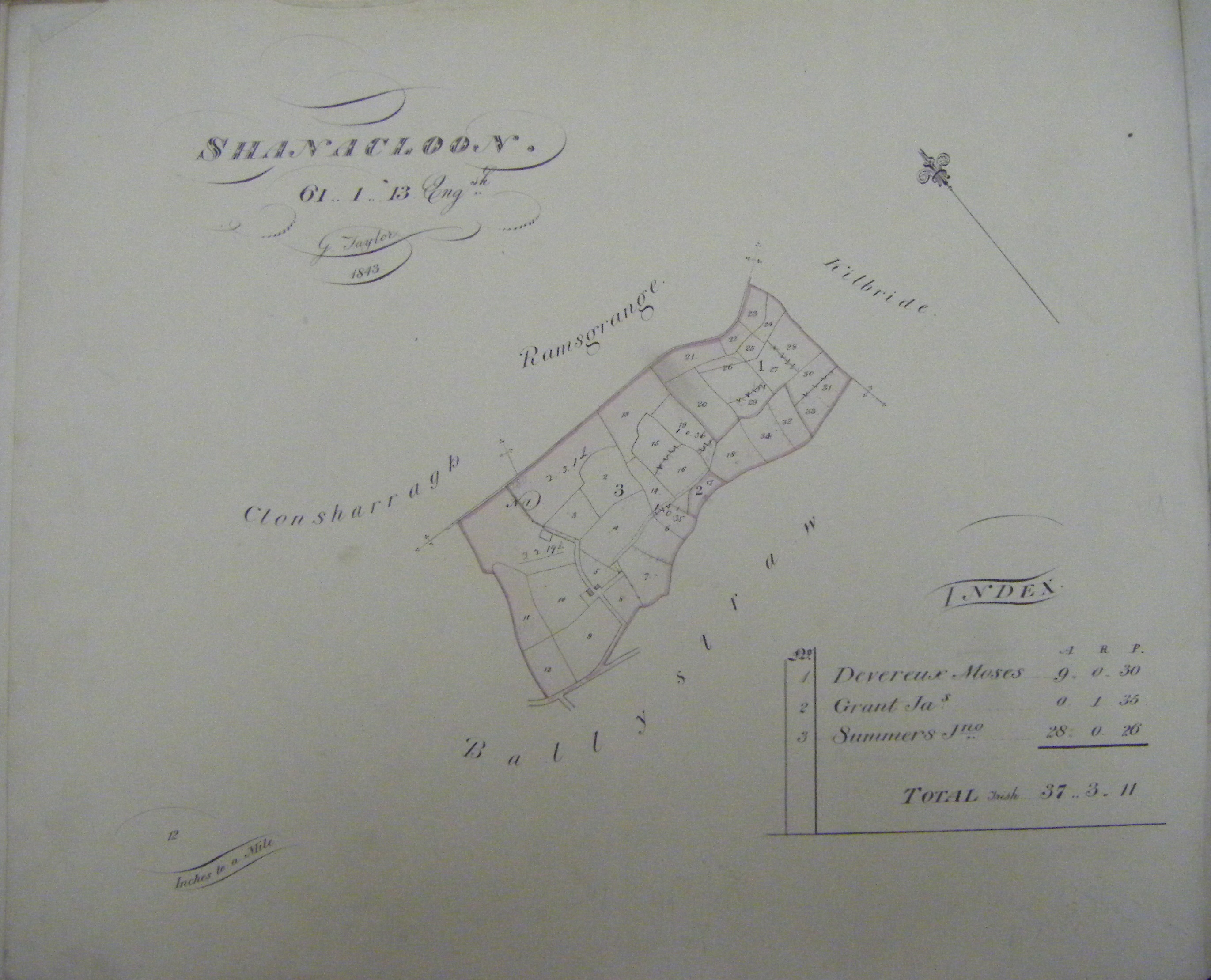
Shanacloan
Lord Templemore Estate Shanacloon Abstract